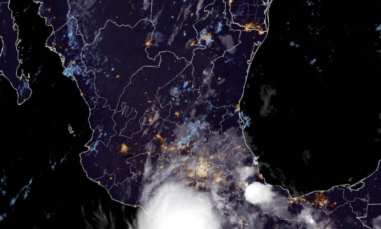
Hurricane Otis Nears Mexico With ‘Catastrophic’ Category 5 Winds

Otis rapidly intensified into a Category 5 hurricane as it approached the southern Pacific Coast of Mexico on Tuesday night, forecasters said, warning that catastrophic damage was likely where the storm’s eye moves onshore.
Hurricane Otis’s maximum sustained winds grew to 160 miles per hour with stronger gusts at about 10 p.m. local time, when it was located 55 miles off the coast of the resort city of Acapulco, the National Hurricane Center said.
The storm was forecast to remain a Category 5 hurricane through landfall overnight into early Wednesday in southern Mexico.
A hurricane warning was in effect for the Pacific Coast of the state of Guerrero, from the beach town of Punta Maldonado to the resort city of Zihuatanejo, forecasters said. A hurricane watch was in effect for part of the western coast of the state of Oaxaca, from Punta Maldonado to Lagunas de Chacahua.
Winds will be “extremely destructive” in the areas under the hurricane warning, forecasters warned. A storm surge was expected to produce “life-threatening coastal flooding” near and to the east of the storm’s center when it makes landfall, they added.
The rainfall could cause flash and urban flooding, as well as mudslides in the mountainous areas, forecasters said. Otis was expected to bring eight to 16 inches of rain across Guerrero and the western coastal sections of Oaxaca through Thursday, with maximum amounts of 20 inches.
Tropical storms with wind speeds greater than 157 m.p.h. are classified as Category 5 hurricanes, the rarest and strongest class on the Saffir-Simpson scale.
